The benefits of GIS
GIS stands for Geographic Information System. At its heart, GIS is software which combines spatial mapping and analysis with database management. It is a powerful set of tools for storing and retrieving data at will, transforming and displaying spatial data from the real world for a particular set of purposes. ArcGIS utilizes a file geodatabase data model, in which files are stored individually in a spatial/relational database and map layers are projected “on the fly” from the path names of the data you choose to view. The type of files it may utilize is virtually limitless, but it takes a skilled analyst to integrate different data types from multiple sources.
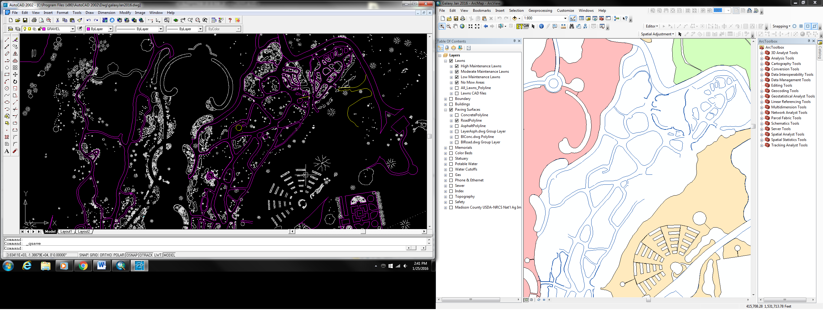
With our map in AutoCAD and our accessions (plant records) in Access, we have the information we need; but it is difficult to keep up with because they are separate (changing one does not change the other) and therefore neither contains complete information about a given map feature. Also, if anyone needs to know anything about a plant in a particular location, they must have Mike or I sort, compile, and decipher the information from different files. This is time-consuming and inefficient and it makes it very difficult for us, as a garden, to share information about our fabulous plants with others.
In GIS, the information is in one location (directory) and linked so changes update both the map geometry (image) and attribute information in the same location, and there are multiple ways to share this information with others. These systems can store mindboggling amounts of information, and how the data is structured depends on its’ intended use. There are two primary types of data: vector and raster. ArcGIS can use both, making it one of the most versatile GIS platforms available. Knowing the location of things, and information about them is important enough; but GIS can also be used to run analyses to combine information from multiple sources and discover relationships between different data sets that may not have been obvious when viewed separately. It draws on arithmetic, algebra, calculus, trigonometry, and statistics to accomplish these things. Examples include deriving aspect and contours, displaying hillshade and visibility analysis, and even tree health assessment using remotely sensed infrared imagery. So, GIS is really powerful; but it is only as good as the data you put into it. One of the most efficient and accurate methods of getting spatial data (geographically accurate projected information with coordinates) is to use a commercial grade handheld GPS. We currently use ages old surveying techniques with a measuring tape and multiple redundant cross checks to ensure acceptable accuracy. We do not have coordinates using this method, so we must line up the geometry manually by sight, which is both time consuming and prone to inaccuracies.
What Can GIS DO?
Save time and money: Simplify keeping our maps and collections data up to date, so we are more efficient and don’t have to rely on outdated information. Enable any employee to have fast and easy access to critical on-site information (such as utilities), reducing maintenance costs.
Connect People: Foster two-way communication about the status of plants and facilities in real time via smart phone applications that can be developed within the GIS platform. Build collaboration with other gardens and research organizations by sharing information about the fantastic wealth of plants we have. Improve the visitor experience by enabling our staff to answer visitor questions on the spot.
Engage our Community: GIS will help our garden increase public awareness, understanding, and concern for plants and their conservation by telling vivid stories and sharing knowledge via maps and other visual tools. We will be able to share our maps and plant information online in a way that is intuitive to use, and easy to interpret and explore.
Some of the information in this post was used with permission from Alliance for Public Gardens GIS.